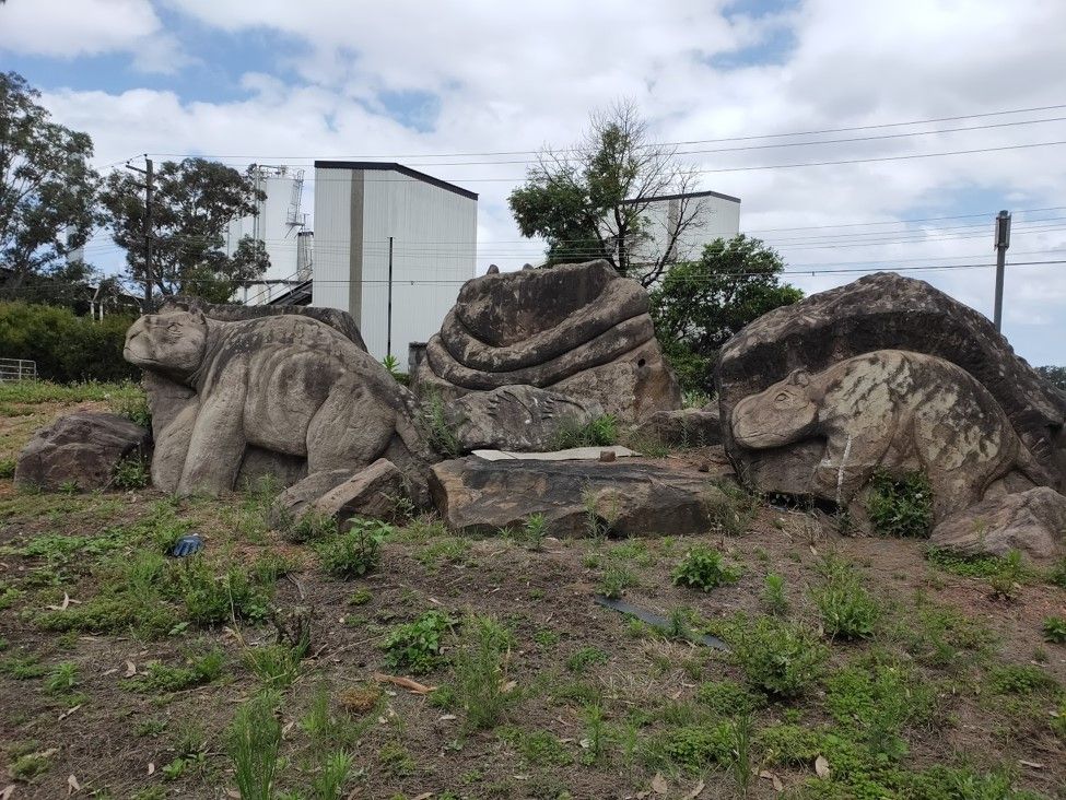
Camellia is currently an industrial area on the south bank of the Parramatta River, and also bounded by the Duck River to the east, the suburb of Rosehill and Grand Avenue in the south, and James Ruse Drive in the west.[1-3]
For more information on Camellia, read our brief history on the suburb[4]. The Camellia - Rosehill precinct is also being redeveloped in line with the Parramatta Light Rail, for more information, please see the Council's precinct planning website on Camellia.[5-6]
|
Street Name |
Origin & Meaning |
Source |
||
|
Colquhoun Street |
Named in honour of Municipality of Granville alderman John Colquhoun |
Monument Australia (2010) John Colquhoun |
||
|
Durham Street |
Part of the Rosehill Township subdivision of 1882 which was auctioned in November by Mobbs and Co. and later Mills and Pile. The streets were laid out in a grid structure and names based on the theme of English counties. Durham is a ceremonial county in North East England |
State Library NSW (2021) - Rose Hill Township : Elizabeth Farm, Z/SP/P6/48 Wikipedia (2021) County Durham |
||
|
Grand Avenue |
This street was designed to overlook (on either side) an available tram service, a considerable real estate advantage at the time. Compelled (by Act) to allow 66 feet (20 metres) of roadway on either side however, the street was of boulevarde proportions and befitted a grand name. The names North Grand Avenue and South Grand Avenue were selected by the subdivider, S.A. Stephen. After the cessation of the tram service the names were combined to "Grand Avenue". |
City of Parramatta (CoP). (1994). Suburban names review: part 1. Parramatta, N.S.W.: Parramatta City Council. |
||
|
James Ruse Drive |
The genesis of today's Freeway in this location was a narrow lane heading from Kissing Point Road to the Orphan School, a lane which was known as Orphan School Lane or Road. After the function of the Orphan School was changed to become Rydalmere Psychiatric Centre the lane was widened and took the name of Rydalmere Avenue. The erection of the bridge linking the road to Aston Street, Rosehill, in 1963 was the commencement of the Freeway system which is now in place, a system which when completed in the 1980's was named after the famed colonial experimental private farmer, James Ruse. |
CoP. (1994) Suburban names review |
||
|
North Grand Avenue |
This street appears to be descriptive as it lies north of Grand Avenue. The road was reconstructed in early 1923 after the Municipality of Granville agreed to fix the street levels of Ashton and North Grand Avenue to the former Camellia station. |
Proposed Grand Avenue. (1923, June 23). The Cumberland Argus and Fruitgrowers Advocate, p. 7 |
||
|
River Road West |
This road continues from Noller Parade between Alfred Street and James Ruse Drive. The road name appears to be based on the theme of naming streets related to the river and natural surrounding. As there is another River Road, the West was added to differentiate between the two. |
State Library NSW (2021) Partial plan Rose Hill Heights, Parramatta subdivision plans Z/SP/P6/108 |
||
|
Thackeray Street |
Previously part of Granville before the suburb of Camellia was assigned on 19 January 2007. |
Notice to lay service pipes. (1896, October 16). NSW Government Gazette, p. 7450. Granville Council. (1901, April 27). The Cumberland Argus and Fruitgrowers Advocate, p. 2. |
Anne Tsang, Research Assistant and Neera Sahni, Research Services Leader, Parramatta Heritage Centre, City of Parramatta, 2021.
Disclaimer: we have tried our best to provide a reason behind how these public roads and streets in Camellia listed got their names but should there be any discrepancies or if you can help us fill in the gaps, please contact us using our online enquiries form
References
- .id consulting & City of Parramatta. (no date). Camellia. In City of Parramatta : Community profile.https://profile.id.com.au/parramatta/about?WebID=110 ;
- McClymont, John. (2008). Camellia, Dictionary of Sydney, http://dictionaryofsydney.org/entry/camellia
- Wikipedia contributors. (2020). Camellia, New South Wales. In Wikipedia, The Free Encyclopedia. https://en.wikipedia.org/wiki/Camellia,_New_South_Wales
- Finlay, Caroline. (2020). Camellia – a brief history. https://historyandheritage.cityofparramatta.nsw.gov.au/blog/2019/12/02/camellia-a-brief-history
- City of Parramatta Council (2020). Camellia https://www.cityofparramatta.nsw.gov.au/councilprecinct-planning/camellia
- State of New South Wales and Department of Planning, Industry and Environment (2018). Camellia. In Planning For Local Communities [portal] https://www.planning.nsw.gov.au/camellia
- State Library of New South Wales (2020). [Camellia subdivision plans, 1838-1919] [cartographic material]. [Sydney, N.S.W.: Various]. https://search.sl.nsw.gov.au/permalink/f/1ocrdrt/SLNSW_ALMA21153563100002626
- Mobbs & Co., Mulligan & Cornfield. (1913) Rosehill township estate : Granville. In State Library of New South Wales. Parramatta Subdivision Plans [cartographic material], 043 - Z/SP/P6/41 http://digital.sl.nsw.gov.au/delivery/DeliveryManagerServlet?dps_pid=IE9140949&change_lng=
- Durham St, York St, Essex St, Suffolk St, Norfolk St, Ruthland St, Derby St, South Ave, Kent St, Devon St, 1913


