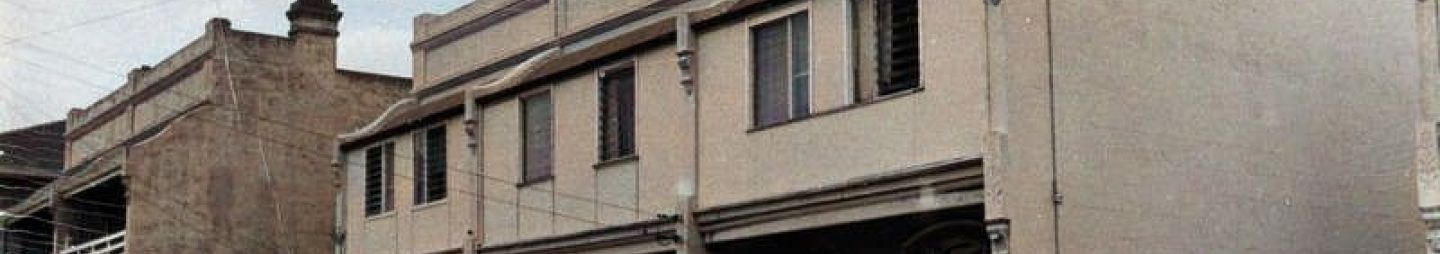
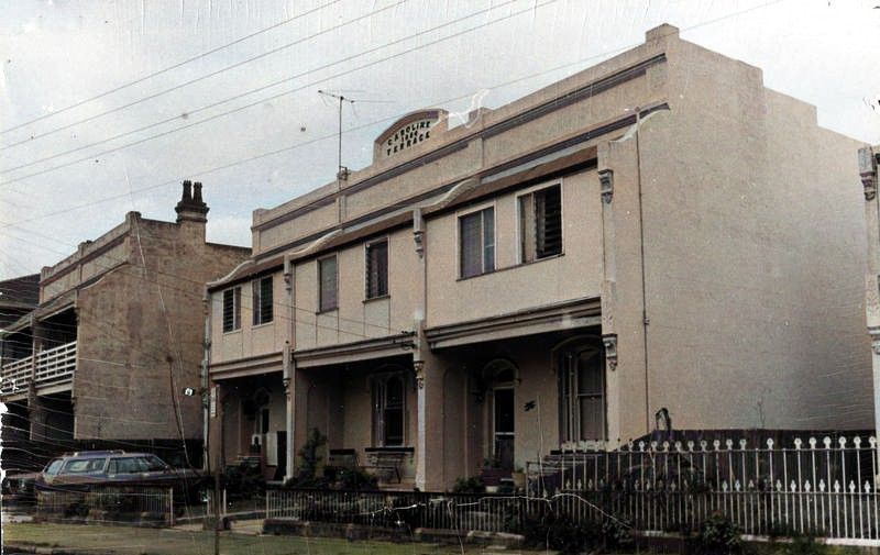
The suburb of Harris Park is bounded by Clay Cliff Creek, Harris Street, Parkes Street and Hassall Street in the north, Alfred Street, Weston Street and Good Street in the east, A'Beckett Creek in the south, and the railway line in the west.[1]
For more information on the suburb, we have written a brief history of Harris Park here [2] or why not take a trip out and discover this heritage precinct also known as Sydney’s Little India.[3]
Below is a compilation of how the streets of Harris Park got their names. Due to the proximity of Harris Park to Parramatta, some of the streets are aligned and an extension of existing public roads. Much of the research has been based on Council’s 1994 Suburban names review, part 1 – written research. Additional resources used include Council’s records and collections; articles and notifications published in the National Library of Australia's Trove database (digitised historical newspapers and Government Gazette’s of NSW); as well as subdivision plans for the area available from the State Library of NSW website[4] and information from various sources as listed in the table under source.
|
Name |
Origin & Meaning |
Sources |
||
|
Ada Street |
First used circa 1878. Acknowledging Ada M Mills, daughter of J. Y. Mills and niece of subdivider C. W. Mills. |
Parramatta City Council (1994) Suburban names review, part 1 – written research. |
||
|
Albion Street |
First used circa 1878. Initially 'Evelyn' Street after Alice Evelyn Mills, niece of subdivider C. W. Mills. The name change was made ten years later to 'Albion', the roman name for 'England', the reason not clear. As there was a high intake of British migrants at the time and a Church of England Church had been established on the corner of Marion Street, the name change could have been for real estate selling purposes. |
Parramatta City Council (1994) Suburban names review, part 1 – written research |
||
|
Alfred Street |
First used circa 1883. Acknowledging (Sir) Alfred Stephen, Chief Justice and former Lt. Governor of NSW, in 'family members and legal friends' street naming theme, Sir Alfred being the father of subdivider, Solicitor S. A. Stephen. |
Parramatta City Council (1994) Suburban names review, part 1 – written research |
||
|
Alice Street |
First used circa 1876. Acknowledging Alice Connor, first wife of inheriting nephew John Harris who attempted an early subdivision of part of the Harris estate. Alice died three years later in 1879. |
Parramatta City Council (1994) Suburban names review, part 1 – written research |
||
|
Allen Street |
First used circa 1878. Acknowledging surname of (Sir) George Wigram Allen, in ' family names' street naming theme, used by subdividing Solicitor G.W. Allen. |
Parramatta City Council (1994) Suburban names review, part 1 – written research |
||
|
Bowden Street |
First used circa 1856. Initially named George Street by the inheritors of George Palmer's estate at the time of subdivision. The name was later changed to avoid confusion and now appears to be an acknowledgement of Thomas Kendall Bowden, Mayor of Parramatta in 1869. Bowden was also a solicitor, cousin and co-partner of G.W. Allen. Appears to also be part of the 'family names' street naming theme used by subdividing solicitor G. W. Allen. |
Parramatta City Council (1994) Suburban names review, part 1 – written research |
||
|
Brisbane Street |
First used circa 1876. Acknowledging Sir Thomas Makdougall Brisbane, former Governor of NSW, who passed away three years earlier in 1873. Brisbane and his family were held in high regard by Parramattans. |
Parramatta City Council (1994) Suburban names review, part 1 – written research |
||
|
Cambridge Street |
First used circa 1882. Reminiscing the town in England but neatly designed to associate with the new railway overbridge provided in that location at the time. |
Parramatta City Council (1994) Suburban names review, part 1 – written research |
||
|
Charles Street |
An extension of Charles Street as created by Governor Lachlan Macquarie circa 1810 to 1814. It appears on his Plan of the township of Parramatta in New South Wales 1814. No origin discovered. |
City of Parramatta Council (2020). Charles Street square upgrade Higginbotham, E. & Johnson, P.A. (1989). The future of Parramatta’s past, volume 1. p. 10. |
||
|
Church Street |
As there were several such families living there, Church Street was originally known as Quaker Row. When Quaker Row was extended to run to St. John's Church, it was renamed Church Street by Governor Macquarie. |
Wickham, J. A. & Yeend, P. J. (1979). Origins of names of suburbs, streets, and localities in and about the Parramatta area, Parramatta, NSW: The King's School Archive Society. Houison, A. (1903). 'Odd bits in the history of Parramatta', Journal and Proceedings of the Royal Australian Historical Society, vol. 1, no. 7, p. 118 |
||
|
Crown Street |
First used circa 1876. Real estate selling name, similar to Prospect street, chosen to indicate the crown of the ridge from which favourable outlook could be gained. |
Parramatta City Council (1994) Suburban names review, part 1 – written research |
||
|
Dalley Street |
First used circa 1878. Initially named Beckett Street as it terminated at Becketts Creek. In the adjoining subdivision, S.A. Stephen used the name "A'Beckett" which created confusion. The creek name was changed to A'Becketts Creek and the Street to 'Dalley St' acknowledging the eminent lawyer, parlimentarian and former member for Cumberland, William Bede Dalley. |
Parramatta City Council (1994) Suburban names review, part 1 – written research |
||
|
East Station Street |
First used circa 1878. Named for real estate selling purposes indicating the advantages of being close to railway station facilities. |
Parramatta City Council (1994) Suburban names review, part 1 – written research |
||
|
Frank Beames Lane |
Frank Beames was Mayor for the years 1889 and 1891 and Alderman 1886 – 1888, 1890. He died 14th March, 1925 |
Bray, Shayne W. (2011). A grand type of citizen : a guide to the mayors and lord mayors of Parramatta, 1861-2011 or Frank Beames |
||
|
Good Street |
First used circa 1883. Initially named 'Elizabeth' Street, acknowledging the inheriting Macarthur grand-daughter, Elizabeth Onslow. Being a prolongation of 'Good Street' Granville (which had been created twenty years earlier) postal confusion developed to the extent that Granville Council changed the name in 1907. The name 'good' appears to have been selected for real estate marketing purposes. |
Parramatta City Council (1994) Suburban names review, part 1 – written research |
||
|
Gordon McKinnon Lane |
First used 1991. Gordon McKinnon (1856-1922) was Scottish-born architect and building surveyor who designed the George Street Gatehouse which was built by the Parramatta Park Trust in 1885, on the site of Governor Macquarie’s small stone lodge. He also compiled and created Fuller's map of Parramatta in 1883. |
Parramatta City Council (1991, December 20). Government Gazette of the State of NSW, p. 10731. Parramatta Park (2020). Monuments and memorials |
||
|
Great Western Highway |
Originally part of a track around the Mays Hill ridge, which became known in 1815 as the Western Road. A survey in 1822 shows the road was now called the Great Western Road |
PCC Street Name Register.pdf Godden Mackay Logan (2000). '1844 Plan of the town of Parramatta and the adjacent properties', in Parramatta historical archaeological landscape management study, volume 3: map volume Brown, S. & Brown, K. (1995). Parramatta: a town caught in time, 1870, Sydney: Hale & Iremonger. |
||
|
Gregory Place |
First used circa 1883. Initially named 'Cliff Street' acknowledging J.W. Cliff, one time owner of 'Elizabeth Farm'. After the property had changed hands several times and, during the 1940s, Mr E.S. Gregory (Manager of Whitehall-now Wyeth- Pharmaceuticals) handed the premises 'Hambledon Cottage' to the public. To eliminate confusion with similarly named streets in the City the street was re-named in the 1960s to acknowledge Mr Gregory. |
Parramatta City Council (1994) Suburban names review, part 1 – written research. |
||
|
Harris Street |
First used circa 1810 and extended circa 1860 and 1876. Acknowledging Surgeon John Harris (1754-1838) and his inheriting nephews and grand-nephews. The name was first used in Macquarie's time but as "Harvey or Harris Street". Thomas Harris extended it as "Harris Street South" in 1860, but in grand-nephew John Harris' subdivision the name of Harris was used. |
McClymont, John (2001) Pictorial history: Parramatta & district, Alexandria: Kingsclear Books. Parramatta City Council (1994) Suburban names review, part 1 – written research. |
||
|
Hassall Street |
First used circa 1876 and extended 1883. Acknowledging James Hassall, grantee of the property which adjoined the street. |
Parramatta City Council (1994) Suburban names review, part 1 – written research. |
||
|
High Street |
This street which is in Parramatta is named for the fact that it was the main street of the town at the time. Name later changed to George Street. High Street was 205 feet wide. |
Town of Parramatta [cartographic material], c 1790-2, adapted from Plants at P.R.O. and in Bonwick Papers. |
||
|
Kendall Street |
First used circa 1878. Acknowledging the distaff family of Thomas Kendall Bowden, cousin and partner of subdividing solicitor G.W. Allen, in 'family names' street naming theme used by subdividing solicitor George Wigram Allen. |
Parramatta City Council (1994) Suburban names review, part 1 – written research. |
||
|
Les Burnett Lane |
First used 1993. |
Parramatta City Council (1993, December 17). Government Gazette of the State of New South Wales, p. 7383. http://nla.gov.au/nla.news-article231948458 |
||
|
Marion Street |
First used circa 1878. Acknowledging (Lady) Marian Allen (nee Boyce), wife of G.W. Allen, in 'family names' street naming theme used by subdividing solicitor George Wigram Allen. |
Parramatta City Council (1994) Suburban names review, part 1 – written research. |
||
|
Oak Street |
First used 1883 and 1904. Not clear. As the land and creek bed in which this street was positioned was cleared land (that is, without trees) it is considered that the street name was probably intended to be "Oakes Street" in acknowledgment of Hon. George Oakes, first Member for Parramatta, who had been accidentally killed in 1881. |
Parramatta City Council (1994) Suburban names review, part 1 – written research. |
||
|
Parkes Street |
Gazetted 12/01/1979. Resolution 24/07/1978. 1895 survey was a continuation of Wentworth Street. Probably named after Sir Henry Parkes or possibly after Varney Parkes, son of Henry Parkes and an architect, who lived in Parramatta at Experiment Farm Cottage in 1884. It was previously known as Ethel Street. |
PCC Street Name Register.pdf |
||
|
Raymond Street |
Previous name: Short Street |
The oracle of Sherwood. (1915, July 3). The Cumberland Argus and Fruitgrowers Advocate, p. 4. http://nla.gov.au/nla.news-article86105067 |
||
|
Rosehill Street |
Street in Rosehill, this area was named Rose Hill in honour of George Rose, secretary to the Treasury by Governor Arthur Phillip in November 1788. The name has contracted to one word over the years. |
PCC Street Name Register.pdf |
||
|
Ruse Street |
First used 1921. Acknowledging James Ruse, grantee, in accordance with the policy of Parramatta Council at that time. |
Parramatta City Council (1994) Suburban names review, part 1 – written research. |
||
|
East Station Street |
Proximity to train station and usually named such for real estate purposes. |
Parramatta City Council (1994) Suburban names review, part 1 – written research. |
||
|
West Station Street |
Proximity to train station and usually named such for real estate purposes. |
Parramatta City Council (1994) Suburban names review, part 1 – written research. |
||
|
Una Street |
First used circa 1878. Acknowledging Isabel Una Mills, daughter of J.Y. Mills and niece of subdivider C.W. Mills. |
Parramatta City Council (1994) Suburban names review, part 1 – written research. |
||
|
Weston Street |
First used circa 1876 extended circa 1883. Acknowledging Frederick Weston who assisted the Harris grand-nephew John, to subdivide the estate. |
Parramatta City Council (1994) Suburban names review, part 1 – written research. |
||
|
Wigram Street |
First used circa 1878. Acknowledging his own distaff family name of Wigram, by the subdividing solicitor, (Sir) George Wigram Allen. |
Parramatta City Council (1994) Suburban names review, part 1 – written research. |
![]()
Emma Stockburn, Research Facilitator and Neera Sahni, Research Services Leader, Parramatta Heritage Centre, City of Parramatta, 2020.
Disclaimer: we have tried our best to provide a reason behind how these public roads and streets in Harris Park listed got their names but should there be any discrepancies or if you can help us fill in the gaps, please contact us using our online enquiries form.
References
- .id Consulting & City of Parramatta. Harris Park. In City of Parramatta : Community profile. https://profile.id.com.au/parramatta/about?WebID=200
- McHardy, Cathy. (2020). Harris Park – a brief history. https://historyandheritage.cityofparramatta.nsw.gov.au/research-topics/suburbs/harris-park-brief-history
- Grossetti, Carla & City of Parramatta Council. (2019). Discover Harris Park. https://www.discoverparramatta.com/see-and-do/discover-harris-park
- State Library of New South Wales. (1883-1924). [Harris Park subdivision plans] [cartographic material]. Sydney, N.S.W. : Various. https://search.sl.nsw.gov.au/permalink/f/1ocrdrt/SLNSW_ALMA21138647990002626 and http://digital.sl.nsw.gov.au/delivery/action/collectionViewer.do?navigation=1&collectionId=477456624&pageNum=20&operation=viewCollection&displayType=list
Further resources in the Research Library Collection
- Parramatta City Council. (2002). Development control plan : Harris Park precinct. – Local Studies Library Shelf Number LS STACK 711.409 PARR
- PPM Consultants. (1996). Harris Park, Rosehill and North Granville : Draft strategic plan for comment and discussion. – Local Studies Library Shelf Number LS STACK 711.4 HAR
- PPM Consultants. (1997). Harris Park, Rosehill and North Granville : strategic plan – Local Studies Library Shelf Number LS STACK 711.4099441 HARR
- Suters Architects Snell. (1996). Harris Park : Cultural landscape masterplan. – Local Studies Library Shelf Number LS STACK 711.4099441 HAR