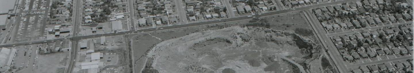
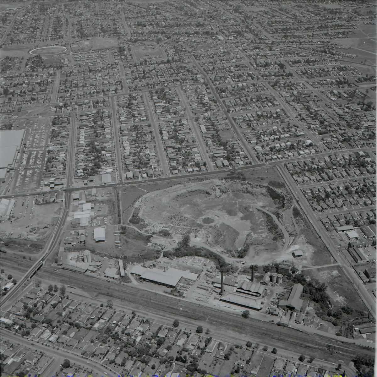
The suburb of Merrylands lies within Cumberland City Council, approximately 3 kilometres south-west of the Parramatta Central Business District. A small area of the suburb comprising the M4 Western Motorway from Mays Hills and Burnett Street ramps to Pitt Street lies within the Rosehill Ward of the City of Parramatta. This short stretch of the M4 Motorway, which was already planned by the late 1960s, is constructed within Merrylands but is part of the City of Parramatta.
Below is a compilation of how the streets of Merrylands got their names. This is based on research found largely in the City of Parramatta Council’s Suburban names review; the New South Wales Government Gazette and Cumberland City Council’s History of the suburbs.
To find out more on the history of the suburb of Merrylands please click here.
|
Name |
|
Origin & Meaning |
|
Source |
|
Abbott Street |
|
Created circa 1883 acknowledging Sir Joseph Abbott, NSW Secretary for Mines,1883, as part of a street naming theme used in the subdivision. |
|
Parramatta Council (199-) Suburban names review, part 1. |
|
Augustus Street |
|
Gazetted 4 May 2007. Street name was originally named Wright Street after Francis Augustus Wright, however due to confusion with another Wright Street Merrylands, the name was changed to Augustus which kept the historic significance of the street name. |
|
|
|
Burnett Street |
|
Created in 1892. |
|
Preliminary notification of streets in the municipalities of Lithgow, Katoomba, Prospect, and Sherwood, Strathfield and Granville. (1892, September 20). New South Wales Government Gazette. |
|
Crossland Street |
|
Created circa 1880. Meaning is unclear. Probably acknowledges one of the investors in the subdivision |
|
Parramatta Council (199-) Suburban names review, part 1. |
|
Derby Street |
|
Created circa 1883 and acknowledges Earl Derby, British Colonial Secretary of the period, part of a street naming theme used in the subdivision. |
|
Parramatta Council (199-) Suburban names review, part 1. |
|
Earl Street |
|
Created circa 1883 and acknowledges Earl Derby, British Colonial Secretary of the period, part of a street naming theme used in the subdivision. |
|
Parramatta Council (199-) Suburban names review, part 1. |
|
Excelsior Street |
|
Created circa 1862. Initially named High Street when created in a subdivision of the Drainwell Estate. In 1922 the postal confusion created between other High Streets in Guildford and Parramatta brought a need for a street name change. Excelsior, a latin equivalent of high was selected by Granville Municipal Council in its place. |
|
Parramatta Council (199-) Suburban names review, part 1. |
|
Farnell Street |
|
Created in 1883 and 1885 and acknowledges James Squire Farnell, NSW Secretary for Lands, 1883, as part of a street naming theme used in the subdivision. An adjoining subdivision carried the name though in 1885. Later the name was extended further to include the section between Woodville Road and Excelsior Street (initially renamed Pitt Street after the subdivider Mr R.M. Pitt) but had to be re-named to avoid postal confusion with Pitt Street Merrylands. |
|
Parramatta Council (199-) Suburban names review, part 1. |
|
Garnet Street |
|
Created circa 1882 and acknowledges Sir Garnet Wolseley who in the year of the subdivision was given command of the British forces and had triumphed at Tel-el-Kebir. |
|
Parramatta Council (199-) Suburban names review, part 1. |
|
Kimberley Street |
|
Created circa 1883 and acknowledges Earl Kimberley holder of several positions in British Prime Minister Gladstone's cabinet at the time of the subdivision. Part of a street naming theme used in the subdivision. |
|
Parramatta Council (199-) Suburban names review, part 1. |
|
Lackey Street |
|
Created circa 1862 and acknowledges Sir John Lackey Member for Parramatta at the time of the subdivision. The Lackey family had extensive land interests in this locality for several decades. |
|
Parramatta Council (199-) Suburban names review, part 1. |
|
Lavinia Street |
|
Created circa 1879 and extended into this neighbourhood in 1883. Acknowledges Lavinia, baby daughter of Reuben Wood, one of the land developers involved in the subdivision of this locality. |
|
Parramatta Council (199-) Suburban names review, part 1. |
|
Lisgar Street |
|
Created circa 1885 and acknowledges Sir John Young (later Lord Lisgar), former Governor of NSW. The name of the estate being subdivided was referred to as the Lisgar Estate. |
|
Parramatta Council (199-) Suburban names review, part 1. |
|
Meadows Street |
|
Created circa 1885 and acknowledges the name of the adjoining estate to Mr J.J. Walters subdivision the Meadows which was well known landmark in the vicinity. |
|
Parramatta Council (199-) Suburban names review, part 1. |
|
Merrylands Road |
|
Merrylands Road was approved in 1868 to join Warren and Woodville Roads. |
|
Parramatta Council (199-) Suburban names review, part 1. |
|
Nowra Street |
|
Created circa 1890. Meaning is unclear. Named by subdivider Mr J.J. Walters, Esquire of Sutton forest |
|
Parramatta Council (199-) Suburban names review, part 1. |
|
Park Street |
|
Created in 1883 after part of the estate (Park Hill) having potential real estate advantages of being nearby to a future public park, now Granville Park. |
|
Parramatta Council (199-) Suburban names review, part 1. |
|
Pitt street |
|
Originally built as a dirt track by early settlers to join the original Redoubt and a nearby bridge. It was originally called Bridge Street. |
|
Confirmation of streets, municipalities of Bombala, Katoomba, Prospect and Sherwood, Strathfield, Kogorah, and Granville. (1892, December 13). New South Wales Government Gazette Kass, T., Liston, C., & McClymont, J. (1996) Parramatta: a past revealed, p. 15 |
|
Reid Street |
|
Created in 1883 and acknowledges Sir George Houston Reid, NSW Minister for Public Instruction 1833, part of the street naming theme used in the subdivision. |
|
Parramatta Council (199-) Suburban names review, part 1. |
|
Robertson Street |
|
Created circa 1879 and initially created in Lackeys subdivision and named Robinson Street acknowledging the then Governor of NSW Sir Hercules Robinson. Subsequent survey plans altered the spelling causing the acknowledgement to fall on the former NSW Premier (including the year 1877) Sir John Robertson. |
|
Parramatta Council (199-) Suburban names review, part 1. |
|
Sutherland Lane |
|
Gazetted 5 June 1992. This street acknowledges Mr Andrew Sutherland Low who owned the estate until 1894 when he accidently drowned. He was a well-known resident of the area who resided in the home known as Southerland House that was later renamed to Locksley Hall and was demolished in 1935. |
|
Parramatta Council (199-) Suburban names review, part 1. |
|
Tara Street |
|
Created circa 1890. Meaning is unclear. Named by subdivider Mr J.J. Walters, Esquire of Sutton forest. |
|
Parramatta Council (199-) Suburban names review, part 1. |
|
Western Motorway |
|
In December 1982, the section of the freeway between Church Street, Harris Park and Great Western Highway, Mays Hill was opened. The east facing ramps were provided at Burnett Street, Merrylands and a westbound off-ramp at Coleman Street. |
|
M4 Western Motorway - Construction Information. (n.d.). Ozroads: The Australian Roads Website |
|
Western Motorway Cycle underpass |
|
Mid 1983 marked the commencement of the Granville Viaduct, the section of elevated freeway between James Ruse Drive and Church Street. |
|
|
|
Zillah Street |
|
Created in 1883 and acknowledges the biblical figure Zillah, who (with Adah) was one of the wives of Lamech. Part of the street naming theme used in the subdivision. |
|
Parramatta Council (199-) Suburban names review, part 1. |
![]()
Caroline Finlay, Regional Studies Facilitator, Anne Tsang, Research Assistant and Neera Sahni, Research Services Leader, Parramatta Heritage Centre, City of Parramatta, 2021.
Disclaimer: We have tried our best to provide a reason behind how these public roads and streets in Merrylands listed got their names but should there be any discrepancies or if you can help us fill in the gaps, please contact us using our online enquiries form.