Westmead is bounded by Toongabbie Creek in the north, the Parramatta River in the north-east, Park Avenue in the south-east, the railway line in the south, and Finlaysons Creek in the west.[1]
For more information on this suburb, read our brief history on Westmead.[2]
|
Name |
|
Origin & Meaning |
|
Source |
|
Alexandra Avenue |
|
Previous name: Station Street and Alexandra Street. First used circa 1920 as part of John Toohey’s estate. |
|
State Library NSW. (unknown) [Sketch plan of Westmead area] D.P. 4036, Z/SP/W10/1 |
|
Alfred Street |
|
Created as part of the subdivision of Down's Estate in 1915, this street most likely references Prince Alfred (1844-1900), given its perpendicularity to Queens Road. |
|
State Library NSW (1915) Down's Estate Westmead, Z/SP/W10/7 |
|
Amos Street |
|
Previous name: Payten Street. Renamed in 1922 by the Municipality of Prospect and Sherwood. Given the time period, this street, which dates back prior to federation (1900), was most likely named after local resident of the area Rev. Richard Amos who settled in the Parramatta area during the mid 1800s. It is interesting to note that a Dr. Bernie Amos grew up in the Westmead area during the 1940s with his grandmother living in the area as well, though there is little evidence to support that the two families are connected. |
|
Molong Argus, (1920), Death of Mr Amos Amos, B. (1988). "Where are those classmates now?", The Parramatta Advertiser |
|
Anderson Street |
|
This street was created when the Wentworth Estate was subdivided in May 1924. The name most likely originates from the developers or the estate owner, though it is unclear |
|
State Library NSW. (1924). Wentworth estate, Parramatta. |
|
Ashley Lane |
|
Between 1909 and 1925, Blacktown Shire Council was required to formalise all un-named roads and as a policy elected to acknowledge fruitgrowers of the district in the street names. In 1931, the Westmead Progress Association asked Blacktown Council to help alleviate the lane flooding from storm water and bad weather which continued to be 'unusable' in 1951 during bad weather. |
|
Blacktown Council (1931, August 17). The Cumberland Argus and Fruitgrowers Advocate, p. 2. |
|
Austral Avenue |
|
This avenue was created during the 1925 subdivision of John Toohey's land, Toohey Palms Estate which was named for the plantation of over 300 palm trees by the developer. This name was most likely given for marketing purposes and to boost the attractiveness of this street by developers Hardie and Gorman Pty Ltd. |
|
State Library NSW. (1925). Toohey Palm Estate, Z/SP/W10/14 |
|
Bailey Street |
|
This street was created during the Parramatta Park - Westmead Estate subdivision of 1903 by Henry. F. Halloran & Co. The origin of this name is unknown but most likely chosen by the developer when this street was created. |
|
Henry F. Halloram & Co., (1903), Parramatta Park, The Westmead Estate. |
|
Belgian Street |
|
Possibly a reference to the Belgians which the residents of Westmead held multiple concerts at the St. Barnabas' Hall in Westmead to raise national relief funds during World War One. |
|
Westmead. [The Belgians]. (1914, September 12). The Cumberland Argus and Fruitgrowers Advocate, p. 5. |
|
Bernard Street |
|
|
|
|
|
Beryl Street |
|
|
|
|
|
Booth Street |
|
|
|
|
|
Brian's Road |
|
|
|
|
|
Bridge Road |
|
Most likely descriptive as this road encompasses a bridge which crosses the railway line. |
|
|
|
Broxbourne Street |
|
Named after Broxbourne poultry farm off Western Road, Mays Hills/Westmead near the former Mays Hill post office. |
|
Black orp (1921, August 27). The Cumberland Argus and Fruitgrowers Advocate, p. 12. |
|
Burnett Street |
|
|
|
|
|
Byrne Street |
|
Previous name: Short Street. |
|
|
|
Caroline Street |
|
Created as part of the Westmead/Parramatta Park subdivision of 1881. This street, as with the neighbouring ones created during this subdivision, are common female names and is most likely given to honour personal figures in the developers' lives. |
|
Mills, Pile and Gilchrist, (1881), "Westmead, Parramatta Park" |
|
Central Avenue |
|
Another descriptive name as Central Avenue is in the centre of Westmead station and was suggested by Mr A. Davies as the street name in front of his property and accepted by Blacktown Shire Council in 1910. |
|
Blacktown Shire Council. (1910, March 26). Windsor and Richmond Gazette, p. 9. |
|
Church Avenue |
|
Part of the Housing Commission model village of the 1940s designed by architect Emil Sodersten who also designed the Australian War Memorial. The Westmead Housing Estate comprised of 300 brick houses adjacent to Toohey’s Palm Estate, a shopping strip on Hawkesbury Road and 18 flats. |
|
Jacaranda will blossom in model village (1947, September 24). The Cumberland Argus and Fruitgrowers Advocate, p. 1. |
|
Coleman Street |
|
Appears as the boundary to Burda Park Estate, Westmead which was auctioned off on Saturday 14 March 1925 at 11:30am by W. F. Jago in conjunction with Messrs. Craig and Herring. |
|
State Library NSW Burda Park Estate [Westmead subdivision plan], Z/SP/M12/10 |
|
Cotswold Street |
|
|
|
|
|
Curtin Place |
|
Part of the NSW Housing Commission model village of the 1940s designed by architect Emil Sodersten who also designed the Australian War Memorial. The Westmead Housing Estate comprised of 300 brick houses adjacent to Toohey’s Palm Estate, a shopping strip on Hawkesbury Road and 18 flats. |
|
Jacaranda will blossom in model village (1947, September 24). The Cumberland Argus and Fruitgrowers Advocate, p. 1. |
|
Darcy Road |
|
This road, which continues through to the neighbouring suburbs of Wentworthville and Pendle Hill, most likely commemorates the Second Fleeter D'Arcy Wentworth (1762-1827), of whom the suburb of Wentworthville is named after. |
|
J. J. Auchmuty, 'Wentworth, D'Arcy (1762–1827)', Australian Dictionary of Biography |
|
Dragonfly Drive |
|
Part of Westmead Hospital precinct. Name was adopted as part of the Westmead Redevelopment after a name the new road competition. It was the suggestion of staff to give the road an Aboriginal title which led to discussions with our local Aboriginal community to identify the most culturally relevant and appropriate name. The name Dragonfly Drive was chosen due to the diverse mix of tribal nations within the western Sydney Aboriginal community. It was suggested by the local Elders that a universally recognised name common to all groups would be the best fit. The chosen name recognises and celebrates this cultural diversity present within western Sydney by connecting groups through the shared narrative of the dragonfly. The dragonfly is seen as a cheeky ‘sticky-beak’ by many Aboriginal communities. They are inquisitive and interested in what is going on. Like bees they are cross-pollinators of plants bringing important medicinal properties from one plant to another. You could think of them as the doctors, nurses and pharmacists of our hospitals. The dragonflly travel from different parts of the state and around Australia, so that medicines are not concentrated in one part of a region. This way all the communities have access to a range of medicines. Dragonflies can also make people think about bringing families together and they are peaceful creatures. Joy, change and adaptability are also qualities that they hold. |
|
NSW Govt. Westmead redevelopment. (2021). New road officially named. |
|
Drew Street |
|
Named after William Drew who owned the land on Good Street, Mays Hill near Parramatta Park. Drew was an alderman who represented the Marsden ward in Parramatta council |
|
|
|
Essington Street |
|
This street shares its name with the historic house nearby, built by William Fullagar (1824-1894) who owned large amounts of land in the surrounding suburbs of Wentworthville and Westmead. The heritage listed house, constructed between 1860 and 1890, has since been purchased by the Church of the Foursquare Gospel and currently serves as a primary school. |
|
Australian Royalty, (n.d.), William Fullagar NSW Office of Environment and Heritage, (n.d.), Essington |
|
Euralla Street |
|
In 1982, Euralla Street was made a short cul-de-sac off School Parade and closed at its intersection with Hawkesbury Road by Holroyd Municipal Council |
|
Holroyd Municipal Council : proposed closure of Euralla Street, Westmead (1982, February 12). Government Gazette NSW, p. 679. |
|
Farmhouse Road |
|
New road gazetted as of 21 November 2018 between Hawkesbury road and Darcy Road, within Westmead Hospital Campus Grounds. |
|
City of Parramatta (2018). Public proposal for new road name - Farmhouse Road |
|
Fenwick Place |
|
Part of the Housing Commission model village of the 1940s designed by architect Emil Sodersten who also designed the Australian War Memorial. The Westmead Housing Estate comprised of 300 brick houses adjacent to Toohey’s Palm Estate, a shopping strip on Hawkesbury Road and 18 flats. |
|
Jacaranda will blossom in model village (1947, September 24). The Cumberland Argus and Fruitgrowers Advocate, p. 1. |
|
Fraser Street |
|
This street was created when the Wentworth Estate was subdivided in May 1924. The name most likely originates from the developers or the estate owner, though it is unclear. |
|
State Library NSW, (1924), Wentworth Estate, Parramatta |
|
Fullagar Road |
|
Previous name: Third Venue. Renamed in 1922 by the Municipality of Prospect and Sherwood. This road was most likely named after William Fullagar (1824-1894) or the Fullagar family in general. William, a prominent landowner and publican in the colony, owned much of Wentworthville and the nearby Westmead during his lifetime. |
|
Australian Royalty, (n.d.), William Fullagar |
|
Gardens Way |
|
Part of Parramatta Park and pathway named as it leads to Wistaria Gardens |
|
Parramatta Park (n.d.) Map |
|
Good Street |
|
|
|
|
|
Gowrie Crescent |
|
Part of a NSW Housing Commission model village developed in the late 1940s. It was designed by architect Emil Sodersten who also designed the Australian War Memorial and comprised of 300 brick houses adjacent to Toohey’s Palm Estate, a shopping strip on Hawkesbury Road and 18 flats. Gowrie Crescent was possibly named after Brigadier General Alexander Gore Arkwright Hore-Ruthven, first Earl of Gowrie, VC, GCMG, CB, DSO & Bar, PC (6 July 1872 – 2 May 1955). Lord Gowrie was a British Army officer who served as the 10th Governor-General of Australia, in office from 1936 to 1945 and had previously served as Governor of South Australia (1928–1934) and Governor of New South Wales (1935–1936). Gowrie Crescent borders MJ Bennett Reserve which is in the centre of the estate and was named after Monty Bennett, a highly respected alderman and Mayor of Holroyd Council who died in office in 1967. |
|
Cumberland Council (2019) Wentworthville ward : Place development plan 2019-2020, p. 10 |
|
Grand Avenue |
|
This avenue was created druring the 1925 subdivision of John Toohey's land, Toohey Palms Estate which was named for the plantation of over 300 palm trees by the developer. This name was most likely given for parketing purposes and to boost the attractiveness of this street by developers Hardie and Gorman Property Limited. |
|
|
|
Great Western Highway |
|
The Great Western Highway is a 201-kilometre-long (125 mile) NSW state highway that links Sydney across the Blue Mountains to Bathurst, on the state's Central Tablelands. |
|
Ozroads (2009) Great Western Highway - history and development Wikipedia (2021). Great Western Highway
|
|
Haig Street |
|
Previous name: Walker Avenue, Wentworthville. Renamed in 1922 by the Municipality of Prospect and Sherwood |
|
Municipality of Prospect and Sherwood. (1922, February 3). Government Gazette NSW, p. 993 |
|
Hainsworth Street |
|
Street named after local resident Joseph Hainsworth who resided on that street. His wife Mary Ann Hainsworth was reported as one of the oldest residents of Westmead prior to her death at the age of 76 on Friday 12 June 1931. |
|
|
|
Hannah Street |
|
|
|
|
|
Hassall Street |
|
Previous name: Railway Street. |
|
|
|
Hawkesbury Road |
|
Previous name: Fullagars Road This road is named after the Hawkesbury River, a 160km long river which has had much significance to both Aboriginal and White Australians. The historic house known as Deskford, constructed in the 1860s, still stands on this road. |
|
Tikkanen, A. (n.d.), Hawkesbury River |
|
Helen Street |
|
Created as part of the Westmead/Parramatta Park subdivision of 1881. This street, as with the neighbouring ones created during this subdivision, are common female names and is most likely given to honour personal figures in the developers' lives. |
|
Mills, Pile and Gilchrist, (1881), "Westmead, Parramatta Park" |
|
Houison Street |
|
This street is most likely named after James Houison (1800-1876), a resident of the Parramatta area and architect for many of its historic buildings. The Houison family later had a farm in Westmead. |
|
Parramatta Historical Society, (n.d.), "James Houison: Parramatta's Forgotten Architect" "Westmead", Parramatta Heritage Center Vertical Files |
|
Howe Street |
|
Part of the heritage listed Deskford Estate in Westmead bounded by Hawkesbury Road, Amos Street and Houston Street which was subdivided and auctioned on Saturday 12 August 1922. |
|
State Library NSW (1922). Deskford Estate Westmead, Mays Hill subdivision plans, Z/SP/M12/3 |
|
Hudson Street |
|
Previous name: Hudson Avenue. Street name altered in 1922 by the Municipality of Prospect and Sherwood under section 249(a) of the Local Government Act 1919. |
|
Municipality of Prospect and Sherwood. (1922, February 3). Government Gazette NSW, p. 993 |
|
Institute Road |
|
Previous name: Hainsworth Road. Now part of the Westmead Hospital precinct. Road renamed as it provides access to Westmead Hospital |
|
|
|
Jessie Street |
|
Created as part of the Westmead/Parramatta Park subdivision of 1881. This street, as with the neighbouring ones created during this subdivision, are common female names and is most likely given to honour personal figures in the developers' lives. |
|
Mills, Pile and Gilchrist, (1881), "Westmead, Parramatta Park" |
|
Jessop Place |
|
Street name approved by the NSW Housing Commission as part of their 1946 Model Village at Westmead. Possibly named in honour of the Jessop family who were natives of Burragorang Valley before settling in Westmead. Oliver Hall Jessop (1863-1944) the patriarch was considered one of the oldest residents in town lived in 1916 with his wife Harriett Jessop (d. 1942) of 52 Hassall Street, Westmead. He had five sons and two daughters who also lived in the area. |
|
The N.S.W. Housing Commission (1946, January 30). The Cumberland Argus and Fruitgrowers Advocate, p. 5. Westmead (1916, July 8). The Cumberland Argus and Fruitgrowers Advocate, p. 11. Return thanks : Jessop (1944, November 29). The Cumberland Argus and Fruitgrowers Advocate), p. 12.
|
|
Jordan Street |
|
Previous name: Jordan Avenue. Part of the Hillcrest Estate on the Heights of Wentworthville. Renamed in 1922 by the Municipality of Prospect and Sherwood |
|
Municipality of Prospect and Sherwood. (1922, February 3). Government Gazette NSW, p. 993. |
|
Joyner Street |
|
Named after Joyner's subdivision which was auctioned on 17 September 1892 by Thorpe and Co. (Parramatta). Plans were obtainable from Mr C. Joyner of May's Hill Post Office, Western Road, Parramatta. Formerly part of the suburb of May's Hill, later Westmead under Prospect and Sherwood. There was a local poultry farmer Samuel John Joyner (and brother Owen James Joyner) who had a poultry farm was along Old Prospect Road (in 1909) from Western Road. |
|
May's Hill estate : Joyner's subdivision. (1892, September 3). The Cumberland Argus and Fruitgrowers Advocate, p. 5. |
|
Killeen Street |
|
Previous name: Killeen Avenue. Renamed in 1922 by the Municipality of Prospect and Sherwood |
|
Municipality of Prospect and Sherwood. (1922, February 3). Government Gazette NSW, p. 993 |
|
Labyrinth Way |
|
Part of Westmead Childrens’ Hospital. Labyrinth Way leads to The Labyrith installed in 2012 opposite Ronald McDonald House. A labyrinth was included in the grounds as a legitimate medical tool to help calm the agitated (from patients, staff, and visiting family and friends) and provide people a quiet place to meditate. |
|
MacGibbon, Ainslie (2010, September 16) Labyrinths offer a new path to health, The Sydney Morning Herald Cookie, Grahame (2018) Westmead Childrens Labyrinth - Westmead, NSW, Australia. Waymarking.com |
|
Lichen Place |
|
Street or place names related to forests species. A lichen is a composite organism that arises from a fungus and an algae or cyanobacteria living among filaments of multiple fungi species in a mutualistic relationship. |
|
Lepp, Heino, Aust. Natl. Botanic Gardens & Aust. Natl. Herbarium. (2011). What is a lichen? |
|
Lydbrook Street |
|
Lydbrook Street appears on the Wentworthville Heights Estate subdivision plan that was auctioned by Parramatta auctioneer Mr W. F. Jago on the grounds on Saturday 7 February 1920 at 3pm (after it was postponed from Saturday 17 January 1920 due to rain). |
|
The sale of the season. (1919, December 20). The Cumberland Argus and Fruitgrowers Advocate, p. 13 Blacktown Memories (2020). Wentworthville Heights Estate, Wentworthville, 1920 |
|
Macarthur Crescent |
|
Street name approved by the NSW Housing Commission as part of their 1946 Model Village at Westmead. |
|
The N.S.W. Housing Commission (1946, January 30). The Cumberland Argus and Fruitgrowers Advocate, p. 5. |
|
Mimosa Street |
|
Street or place names related to plants. Mimosa or Acacia dealbata, the silver wattle, or blue wattle, is a species of flowering plant in the legume family Fabaceae, native to southeastern Australia in New South Wales. |
|
Wikipedia (2021). Acacia dealbata
|
|
Mons Road |
|
Named for a town in Belgium which was the site of battles during both World Wars. |
|
Randwick City Council (n.d.) Street names M-R |
|
Moree Avenue |
|
This avenue was created during the 1925 subdivision of John Toohey's land, Toohey Palms Estate which was named for the plantation of over 300 palm trees by the developer. This name was most likely given for parketing purposes and to boost the attractiveness of this street by developers Hardie and Gorman Property Limited. |
|
State Library NSW. (1925). Toohey Palm Estate, Z/SP/W10/14 |
|
Moss Place |
|
Street or place names related to forests species. A moss is a flowerless, spore-producing plant - with the spores produced in small capsules. |
|
Lepp, Heino, ANBG & ANH. (2008). What is a moss? |
|
Mowle Street |
|
This street was created during the Parramatta Park - Westmead Estate subdivision of 1903 by Henry. F. Halloran & Co. The origin of this name is unknown but most likely chosen by the developer when this street was created. |
|
Henry.F.Halloram & Co., (1903), Parramatta Park, The Westmead Estate |
|
Nolan Crescent |
|
Part of the NSW Housing Commission to develop a model village in the late 1940s. The Westmead Housing Estate designed by architect Emil Sodersten comprised of 300 brick houses adjacent to Toohey’s Palm Estate, a shopping strip on Hawkesbury Rd and 18 flats. Nolan Crescent appears to have been named after then chairman of the Housing Commission Mr Barton Hopetoun Nolan (1901-1953). |
|
Westmead plan. (1944, March 20). The Sydney Morning Herald, p. 7 Jacaranda will blossom in model village (1947, September 24). The Cumberland Argus and Fruitgrowers Advocate, p. 1.
|
|
North Avenue |
|
Part of the Westmead Hospital Staff Accommodation at 105 Bridge Road, Westmead corner Darcy Road |
|
NSW Health Western Sydney Local Health District (2013) Asset Strategic Plan 2013-2023 |
|
Oakes Street |
|
Previous name: Park Avenue. This street derives its name from the original name of this area owned by George Oakes (1813-1881), Oakes Orchard, which grew primarily oranges until the value of this land grew too valuable for orchard purposes. It was renamed after the Westmead United Progress Association submitted a request to change the name and Holroyd Council approved the request in late November 1939. |
|
Westmead road name changed. (1939, November 22). The Cumberland Argus and Fruitgrowers Advocate, p. 8. West, Peter. (1986). A short history of Western Sydney, p 4. |
|
Paringa Avenue |
|
Part of the Westmead Hospital precinct. The avenue may be named in connection with the Paringa Unit, Cumberland Hospital’s adult inpatient mental health unit. Paringa is from an Aboriginal word meaning "big bend in the river". In South Australia, Paringa is a small town with a bridge across the Murray River in Australia |
|
Wikipedia. (2020). Paringa, South Australia. |
|
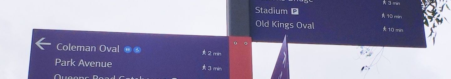
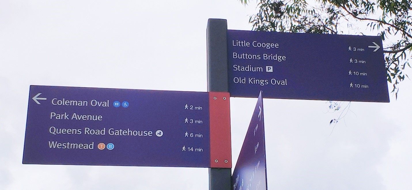
Park Avenue |
|
Previously known as West mead Avenue. This street was renamed Park Avenue as it borders Parramatta Park |
|
|
|
Park Parade |
|
A descriptive name as the parade runs along the outside southern border of Parramatta Park alongside the railway line. |
|
|
|
Parkside Lane |
|
A descriptive name as the lane is located on the side of the southern domain/Mays Hill of Parramatta Park |
|
|
|
Patricia Street |
|
Developed as part of the September 1947 State Housing Commission Project no. 734 in Mays Hills |
|
More homes for district (1949, September 21). The Cumberland Argus and Fruitgrowers Advocate, p. 8. |
|
Priddle Street |
|
This street was created during the Parramatta Park - Westmead Estate subdivision of 1903 by Henry. F. Halloran & Co. The origin of this name is unknown but most likely chosen by the developer when this street was created. |
|
Henry.F.Halloram & Co., (1903), Parramatta Park, The Westmead Estate |
|
Pye Street |
|
It is most likely that this street was named after James Pye (1801-1884) who was born in the nearby suburb of Toongabbie and grew various fruits, particularly oranges, in the area. Later in life, he was elected to the lower house of the NSW parliament as well as his local council. |
|
G. P. Walsh, 'Pye, James (1801–1884)', Australian Dictionary of Biography |
|
Queens Road |
|
Created as part of the subdivision of Down's Estate in 1915, this street is named based on a royalty theme. |
|
State Library NSW (1915) Down's Estate Westmead, Z/SP/W10/7 |
|
Railway Parade |
|
A descriptive name as the parade runs parallel to the railway line. |
|
Street names. (1925, July 24). The Cumberland Argus and Fruitgrowers Advocate, p. 3. |
|
Ralph Street |
|
Named after land holder Frank Ralph (c.1866-1933) of "Campong Bahrn", Hawkesbury Road, Westmead. Ralph and his wife were both actively involved in many local community organisations including Red Cross, the Westmead Progress Hall, Parents and Citizens' Association, Returned Servicesmens' Leagues, and supported St Andrews Presbyterian Church |
|
Death of Mr. F. Ralph (1933, November 16). The Cumberland Argus and Fruitgrowers Advocate, p. 5. |
|
Redbank Road |
|
Named after a former destination known as Redbank in Westmead 9then known as Back Domain) that once bordered the old cemetery reserve and Toongabbie Creek. Today there is also a bush walking track known as Redbank track that traverses Toongabbie Creek through the open vistas of Northmead and Wentworthville. Other places include co-located Westmead Hospital's Redbank House and Redbank School - a NSW Department of Education School for Specific Purpose and Redback Childrens Centre. |
|
NSW Govt. (Western Sydney Local Health District). (no date). Redbank House NSW Dept. of Education (n.d)
City of Parramatta (2020) Bushwalks of Parramatta |
|
Reid Avenue |
|
Given the proximity of Reid Avenue to Shannons Paddock, it can be assumed the street is named after William Robert Reid Shannon (c1891-1929) who was managing director of Shannon's Brick, Tile and Pottery Pty Limited in Wentworthville and an alderman for six years with Holroyd council. Shannon's also owned the neighbouring Darcyville Estate in Wentworthville. Reid Avenue later appears on the 'Wentworthville Heights Estate' subdivision plan that was auctioned by Parramatta auctioneer Mr W. F. Jago on the grounds on Saturday 7 February 1920 at 3pm (after it was postponed from Saturday 17 January 1920 due to rain). |
|
State Library of NSW (n.d) Darcyville Estate, Wentworthville subdivision plans, Z/SP/W8/6 Notice under Real Property Act. No. 22,142. (1919, October 31). Government Gazette NSW, p. 5923. Blacktown Memories (2020). Wentworthville Heights Estate, Wentworthville, 1920. Mr. W. R. R. Shannon. (1929, June 6). The Sydney Morning Herald, p. 8. |
|
Riverview Clinic |
|
Part of the Westmead Hospital Precinct. The street leads to Riverview Unit, one of three Cumberland Hospital mental health specialist admissions units |
|
NSW Govt. (Western Sydney Local Health District). (n.d.). About mental health services. |
|
School Parade |
|
Street name approved by the NSW Housing Commission as part of their 1946 Model Village at Westmead. This parade, ironically, is home to no schools, but is in the vicinity of several high and public schools. |
|
The N.S.W. Housing Commission. (1946, January 30). The Cumberland Argus and Fruitgrowers Advocate, p. 5. |
|
South Avenue |
|
Part of the Westmead Hospital Staff Accommodation at 105 Bridge Road, Westmead corner Darcy Road |
|
|
|
Telfer Place |
|
|
|
|
|
Thomas Clarke Street |
|
Possibly named after Thomas James Clarke, a former resident of Parramatta who was a well-known Parramatta cricket player. He was married to May Giles, whose family was for a long time residents of Parramatta and was in charge of Parramatta Park. He also worked as a staff member of the Cumberland Mercury newspaper and was involved in many public movements during World War One. |
|
Death of Mr. T. J. Clarke (1936, August 13). The Cumberland Argus and Fruitgrowers Advocate, p. 7. |
|
Thomas May Place |
|
This place was most likely named to commemorate Thomas May (1804-1873) who arrived in Australia as an infant, along with his mother andconvict father. He later purchased property in Parramatta and became a councillor for the Phillip Ward in 1846 to 1850. May's homestead, known as Park Lodge, stood in Westmead and is likely the reason for this street's naming. |
|
City of Sydney Archives (n.d.) "Thomas May, Sydney's Aldermen |
|
Toohey Avenue |
|
This avenue is named after the original landowner and estate, John Toohey, whose property stretched to the railway and was subdivided in 1925 as part of the Toohey Palms Estate. |
|
Slack & Co. (1903). Hinton's subdivision, Westmead, Z/SP/W10/9 |
|
Veron Street |
|
Previous name: Veron Avenue. Part of the Hillcrest Estate on the Heights of Wentworthville. Name altered in 1922 by Municipality of Prospect and Sherwood. |
|
State Library NSW Hillcrest Estate [Wentworthville subdivision plans] Z/SP/W8/29
|
|
Wentworth Avenue |
|
Named in honour of Darcy Wentworth and his family who held land in the area. The avenue is parallel to the railway line and extends from Bridge Road, Westmead to Toongabbie station, passing through the suburbs of Wentworthville and Pendle Hill. |
|
|
|
West Domain Avenue |
|
Part of Parramatta Park and named as it lies on the border of the West Domain of the Park. |
|
Parramatta Park (n.d.) Map |
|
Westville Place |
|
Part of the Housing Commission model village of the 1940s designed by architect Emil Sodersten who also designed the Australian War Memorial. The Westmead Housing Estate comprised of 300 brick houses adjacent to Toohey’s Palm Estate, a shopping strip on Hawkesbury Road and 18 flats. |
|
Jacaranda will blossom in model village (1947, September 24). The Cumberland Argus and Fruitgrowers Advocate, p. 1. |
|
Whitworth Street |
|
The Whitworth Estate once existed in Westmead, most likely owned by Joseph Whitworth (c.1831-1896), a local resident of the Parramatta and Westmead area. |
|
Ancestry.com (n.d.) Joseph Whitworth |

Anne Tsang, Research Assistant & Neera Sahni, Research Services Leader, Parramatta Heritage Centre, City of Parramatta, 2021
Disclaimer: We have tried our best to provide a reason behind how these public roads and streets in Westmead listed got their names but should there be any discrepancies or if you can help us fill in the gaps, please contact us using our online enquiries form.
References
- .idcommunnity & City of Parramatta. Westmead. In Community profile. https://profile.id.com.au/parramatta/about?WebID=360
- McHardy, Cathy & Sahni, Neera. (2020). Westmead – a brief history. https://historyandheritage.cityofparramatta.nsw.gov.au/blog/2020/02/27/westmead-a-brief-history
- [Westmead subdivision plans] [cartographic material]. (1896-1925). Sydney, NSW: Various. Available online via the State Library of NSW at: http://digital.sl.nsw.gov.au/delivery/action/collectionViewer.do?navigation=1&collectionId=487008787&pageNum=20&operation=viewCollection&displayType=list
- [Mays Hill subdivision plans] [cartographic material]. (1914-1925). Sydney, NSW: Various. Available online via the State Library of NSW at: http://digital.sl.nsw.gov.au/delivery/action/collectionViewer.do?navigation=1&collectionId=483482614&pageNum=20&operation=viewCollection&displayType=list
- [Parramatta subdivision plans] [cartographic material]. (1876-1925). Sydney, NSW: Various. Available online via the State Library of NSW at: http://digital.sl.nsw.gov.au/delivery/action/collectionViewer.do?navigation=1&collectionId=488981729&pageNum=20&operation=viewCollection&displayType=list
- [Wentworthville subdivision plans] [cartographic material]. (1881-1920). Sydney, NSW: Various. Available online via the State Library of NSW at: http://digital.sl.nsw.gov.au/delivery/action/collectionViewer.do?navigation=1&collectionId=487008745&pageNum=20&operation=viewCollection&displayType=list