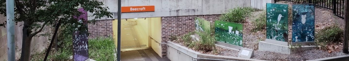
Beecroft railway station entrance from Wongala Crescent with ‘Our Place’ artwork panels by Amanda Kay and Jerome Dobinson.[1]
The suburb of Beecroft is split between the City of Parramatta and Hornsby Shire Council. The table below focuses on the part of Beecroft that is within the City of Parramatta Local Government area that is bounded by the Hills (M2) Motorway in the north, the waterway in the east, generally by Plympton Road, Norwood Avenue, Karril Avenue and North Rocks Road in the south, and generally by Pennant Hills Road and Maher Close in the west.[2] For more information on Beecroft, read our brief history of the suburb here.[3]
|
Name |
Origin & Meaning |
Source |
|||
|
Allerton Road |
Named after Pierce Crosbie McDonnell's property "Allerton" which was on Murray Farm Road, Beecroft circa 1914 |
Beecroft. (1918, August 31). The Cumberland Argus and Fruitgrowers Advocate, p. 8 ; Advertising (1920, March 6). The Sydney Morning Herald, p. 22. |
|||
|
Bambara Crescent |
An Aboriginal word meaning "forest" |
Patrick, T. G. (c1994). Street names of Pennant Hills and surrounding suburbs of Beecroft, Cheltenham, Cherrybrook, Thornleigh, Westleigh and West Pennant Hills. Hornsby, N.S.W. : Silicon Quill, p. 5 |
|||
|
Bingara Road |
An Aboriginal word meaning "creek" or "bark of a tree" |
Patrick, T. G. (c1994, p. 7) |
|||
|
Carlool Road |
An Aboriginal word meaning "a kurrajong", Brachychiton populneum, a native Australian tree that produces nutritious pollen much prized by bee keepers |
Patrick, T. G. (c1994) |
|||
|
Edward Avenue |
|||||
|
Ferndale Road |
Formerly part of Nelson Estate. Previous name (circa January 1926): Olaf Street and Joyce Street. Ferndale refers to a small valley where ferns grow |
Patrick, T. G. (c1994, p. 29) ; Hornsby Shire Council. (1926). Nelson Estate - Beecroft, Hornsby Shire Recollects. |
|||
|
Finlay Avenue |
Named after the Finlay family who were related to Pierce Crosbie McDonnell, the owner of a large stock and farming property known as Allerton. |
Advertising (1920, March 6). The Sydney Morning Herald, p. 22. |
|||
|
John Street |
|||||
|
Karril Avenue |
An Aboriginal word meaning "evening" |
Patrick, T. G. (c1994). Street names of Pennant Hills and surrounding suburbs of Beecroft, Cheltenham, Cherrybrook, Thornleigh, Westleigh and West Pennant Hills. Hornsby, N.S.W. : Silicon Quill, p. 43 |
|||
|
Keira Place |
An Aboriginal word meaning "river of sweet water" or "large lagoon" or "high mountain" |
Patrick, T. G. (c1994, p. 44) |
|||
|
Kungala Road |
An Aboriginal word meaning "foam" |
Patrick, T. G. (c1994, p. 46) |
|||
|
Lamorna Avenue |
Named after Lamorna Pty Limited which was on Murray Farm Road, Carlingford (Vol. 8265- Folio 192 DP 31832 PA 45857) |
|
|||
|
Lynbrae Avenue |
|||||
|
M2 Hills Motorway |
Since early 2013, the Roads and Maritime introduced a new road numbering system and new names for some important routes across the state network which includes a combination of a letter and a number from 1 to 99. ‘M’ stands for motorway. |
||||
|
Maher Close |
Named for the Maher family who were orchardists in the area. In 1855, Edward Maher bought 28 acres of land from the southern third of Reverend Samuel Marsden's Mount Wilberforce property. |
Beecroft-Cheltenham History Group (1995). Beecroft and Cheltenham : the shaping of a Sydney community to 1914. Beecroft, N.S.W.: The Group Patrick, T. G. (c1994). Street names of Pennant Hills and surrounding suburbs of Beecroft, Cheltenham, Cherrybrook, Thornleigh, Westleigh and West Pennant Hills. Hornsby, N.S.W. : Silicon Quill, p. 53 |
|||
|
Marron Place |
An Aboriginal word for an Australian freshwater crayfish, of the genus Cherax usually found in Western Australia. |
Macmillian Publisher (2021). marron, Macquarie Dictionary : Australian word map |
|||
|
Marwood Drive |
|||||
|
Mawson Avenue |
|||||
|
Midson Road |
This old timber road was named after the Midson family in 1889 who owned the land surrounding this road in 1883. |
McAndrew, Alex. (2002). An ABC of Epping, p. 235 |
|||
|
Murray Farm Road |
Originally known as Murray Road, after early landholder Andrew Murray and shown on the 1882 Murray's Estate subdivision plan. In 1940s, a section west of Devlins Creek was renamed Murray Farm Road |
Beecroft-Cheltenham History Group (1995). Beecroft and Cheltenham : the shaping of a Sydney community to 1914. Beecroft, N.S.W. : The Group |
|||
|
Nallada Place |
An Aboriginal word meaning "grass" |
Patrick, T. G. (c1994). Street names of Pennant Hills and surrounding suburbs of Beecroft, Cheltenham, Cherrybrook, Thornleigh, Westleigh and West Pennant Hills. Hornsby, N.S.W. : Silicon Quill, p. 73 |
|||
|
Norwood Avenue |
|||||
|
Orchard Road |
First used in 1882. Named because of the suitability of the area for orcharding. The Beecroft area had many orchards growing oranges, mandarines and lemons. |
Beecroft-Cheltenham History Group (1995). Beecroft and Cheltenham : the shaping of a Sydney community to 1914. Beecroft, N.S.W. : The Group, p. 80-81 Patrick, T. G. (c1994). Street names of Pennant Hills and surrounding suburbs of Beecroft, Cheltenham, Cherrybrook, Thornleigh, Westleigh and West Pennant Hills. Hornsby, N.S.W. : Silicon Quill, p. 75 |
|||
|
Pennant Hills Road |
First used in 1828. |
||||
|
Redgrove Avenue |
Formerly part of Nelson Estate. Previous name (circa January 1926): Frederick Street and Lily Street. Redgrove is a topographic surname, which was given to a person who resided near a physical feature such as a hill, stream, church, or type of tree. In this case the place-name was originally derived from the Old English terms red meaning reed and graf meaning ditch or grove. |
Hornsby Shire Council. (1926). Nelson Estate - Beecroft, Hornsby Shire Recollects. House of names (n.d.) Redgrove history, family crest & coats of arms |
|||
|
Roselea Way |
|||||
|
Saracen Road |
Formerly part of Nelson Estate. Previous name (circa January 1926): Sina Street. Saracen is defined as a member of the nomadic peoples of the Syrian and Arabian deserts at the time of the Roman Empire. It was also a term widely used among Christian writers in Europe durint the Middle Ages to refer to an Arab or Muslim person. |
Patrick, T. G. (c1994). Street names of Pennant Hills and surrounding suburbs of Beecroft, Cheltenham, Cherrybrook, Thornleigh, Westleigh and West Pennant Hills. Hornsby, N.S.W. : Silicon Quill, p. 91 ; Wikipedia. (2020). Saracen Hornsby Shire Council. (1926). Nelson Estate - Beecroft, Hornsby Shire Recollects. |
|||
|
Sunhaven Street |
Disclaimer: we have tried our best to provide a reasoning for how the public roads and streets in Beecroft listed got their names but should there be any discrepancies or if you can help us fill in the gaps, please contact us using our online enquiries form
![]()
Anne Tsang, Research Assistant & Neera Sahni, Research Services Leader, Parramatta Heritage Centre, City of Parramatta,2021.
References
- T3D.Design (2019). Beecroft Station Sydney. https://www.t3d.design/beecroft-station-sydney
- id consulting & City of Parramatta. Beecroft. In City of Parramatta : Community profile. https://profile.id.com.au/parramatta/about?WebID=100
- Tsang, Anne. (2020). Beecroft – a brief history. Retrieved from https://historyandheritage.cityofparramatta.nsw.gov.au/blog/2020/02/24/beecroft-a-brief-history